|
Views of W. Arunachal Pradesh
Images (Dirang-Tawang)
Page content :
Images from the Dirang and Tawang
Links to images of other areas
Pakke
Eaglenest
Dirang-Tawang
Dirang
click on the thumbnails for a larger
image
|
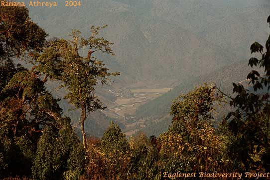
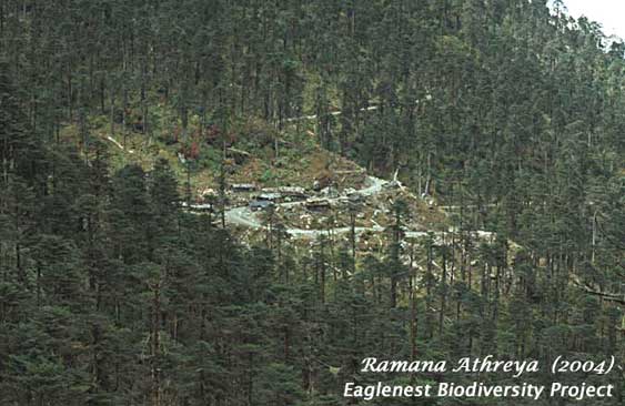
The Sangti valley
A distant view from high up on the Mandala
ridge. Dirang is a good base for visting Sangti and Mandala.
|
|
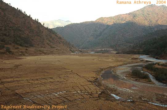
The Sangti Paddies
The black-necked cranes find their winter sustenance
on the fallow paddies between the two halves of Sangti village. 0-10
visit the valley between November, when they move away from their summer
haunts, and February, when the Sangti folk start their spring
operations. The cranes have put in a show regularly for the last 8 years. |
|
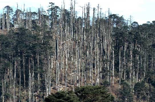
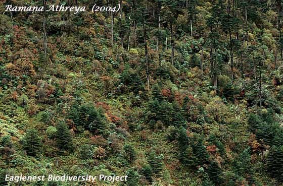
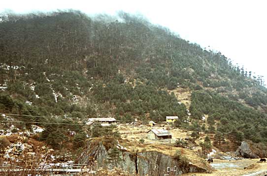
The Mandala Ridge
Has extensive conifer stands, highly disturbed in
patches and excellent in others. The road follows the ridge at about
3600m. There are several large man-made grazing pastures along the road
but there are no alpine meadows (too low). Pictured opposite is a
pasture in the making - the central patch of conifers have been girdled
to death and only await clearing.
|
Tawang
click on the thumbnails for a larger
image
|
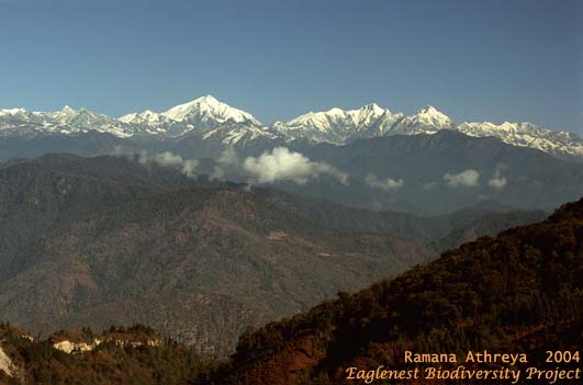
The Greater
Himalayas from Bomdila
The Sela ridge divides W. Kameng from Tawang.
The highway winds up to and across this ridge at the Sela Pass at
4200m. Even this high ridge is dwarfed by the Greater Himalayas
beyond; the summits of Gorichen (6540m) and Kangto (7090m) are the
highest in the state and sentinels on the border with Tibet.
|
|
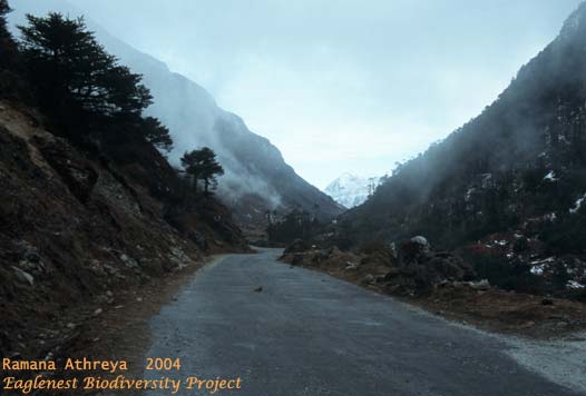
Sela viewed from the Tawang side
The road goes down by easy gradients into Tawang
passing through alpine meadows, dwarf treeline vegetation and, of
course, extensively deforestation in all easily accessible conifer
patches. The heartening sight is the healthy regeneration of
conifers in all areas abandoned and undisturbed by people for a
couple of decades. |
Deforested scrub
|
Treeline Vegetation
|
Conifer Regeneration
|
|
 |
 |
|
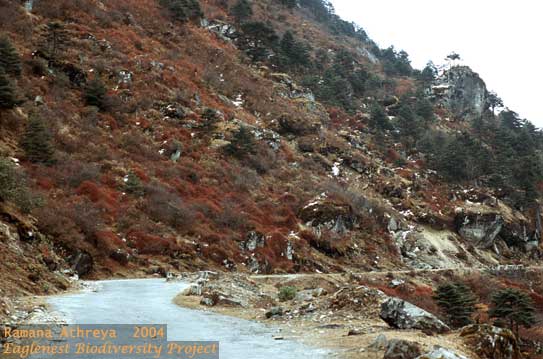
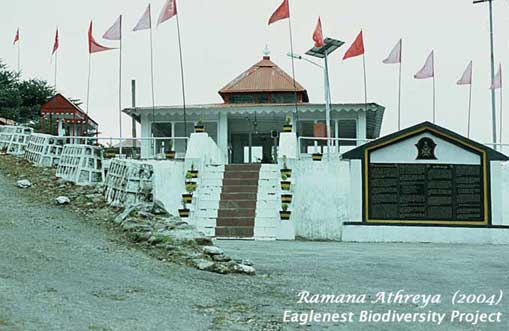
Jaswantgarh
A memorial to Jaswant Singh, one of the few Indian
soldiers to get a gallantry award in the Chinese disaster of 1962.
Located at the mouth of the Sela valley it commands a spectacular view
of the Tawang Valley (next image)
|
|
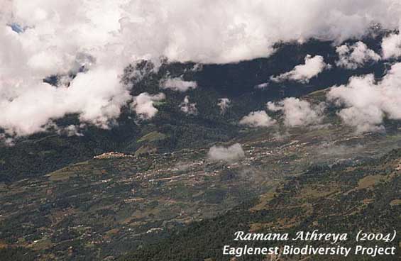
The Tawang Valley
The dense packed cluster a little left of the centre
is the 400 year old Tawang Monastery. The Dalai Lama used the
ancient Tibet-Tawang route to escape from the Chinese authorities
in the 1950s, and spent some time here before moving on to Himachal
Pradesh.
|
|
The Jang - Rama Spur road
The road climbs up from 2400m at Jang to 3850m
before climbing down to PanGi below Thingpo, passing through some of the
best stands of Fir in that region. Most of the trees below 3000m have
been felled to provide fuel to Jang. One can climb up from the
highest point on the road to the alpine zone above.
|
(top)
The Eaglenest
Biodiversity Project was
funded by a grant from the Rufford Foundation (UK) to Ramana Athreya.
The information contained herein may be freely
used, provided that these webpages and/or the report (Athreya 2005)
are appropriately cited. The images are copyright and may
not be reproduced without permission from Ramana Athreya
The
author would appreciate an email
from people, scientists and tourists alike, who found these webpages
useful. |
|