Home Links
NRAO, the National Radio Astronomy Observatory
NRAO Astronomical Image Processing System (AIPS)
Cone Search
(uses cookies)| Name look up : (paste J2000 below) |
Separate VLA images:
Browse:
Version 2022-Sep-02 [an error occurred while processing this directive]
Browse the image directories
The table below lists all (truncated phase-center) positions that
have images and calibrated uv-data sets processed with the VLA
pipeline for you to browse. No 4-band and P-band images were made;
also the emphasis in the pilot was at C-band and X-band, meaning that
for the range November 1999 to March 2000 other bands may be missing.
Also note that the special surveys (e.g., the NVSS, the NRAO VLA
Sky Survey) were not redone - to browse those and to use their postage
stamp servers you can follow the links to their home pages on the
left.
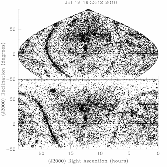
Currently
(2010-Jul-12) we have
[an error occurred while processing this directive] VLA images of
42808
sky positions
and the following sky coverage:

You can browse the images at any position by clicking on the
position/directory below. Next to the position/directory, the number of
images at/in that position/directory is listed in brackets. Read README
(pop-up
window/in
the browser) for file name explanations.
For cone searches
around a position, use the cookie tool in the menu on the left!
The Right Ascention and Declination (in
J2000 coordinates) go by four from left to right, and then from top
to bottom. Note that your favourite source may be in a neighboring
directory if the observer did not directly point toward your region of
interest. Image file names end with the approximate radius from
the center (usually in arcminutes (M), or in degrees (D) or arcseconds
(S)) that is imaged; it is for you to decide whether you can use a
neighboring directory image as well instead... Or use the cone search
in the menu at the left.
Quick Jump to R.A. ..:
Image directories (and number of images)
Modified on 2010-Jul-12 (index), 2007-Apr-17 (canvas)