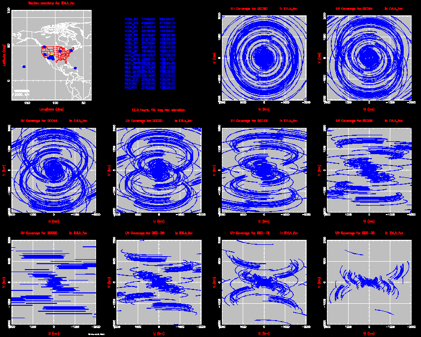
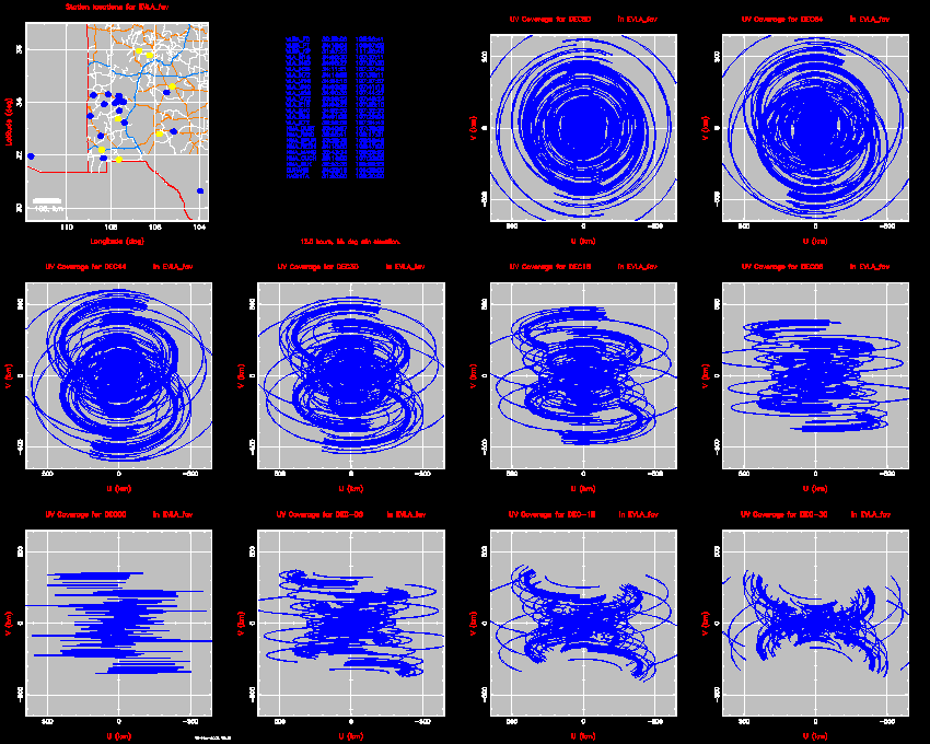
Here are some UV plots for the current favorite NMA configuration as of
Nov2002. This array is based on assumptions that the VLBA station at
Los Alamos will have to be moved and that fiber access along the
Rio Grande Valley will be difficult.
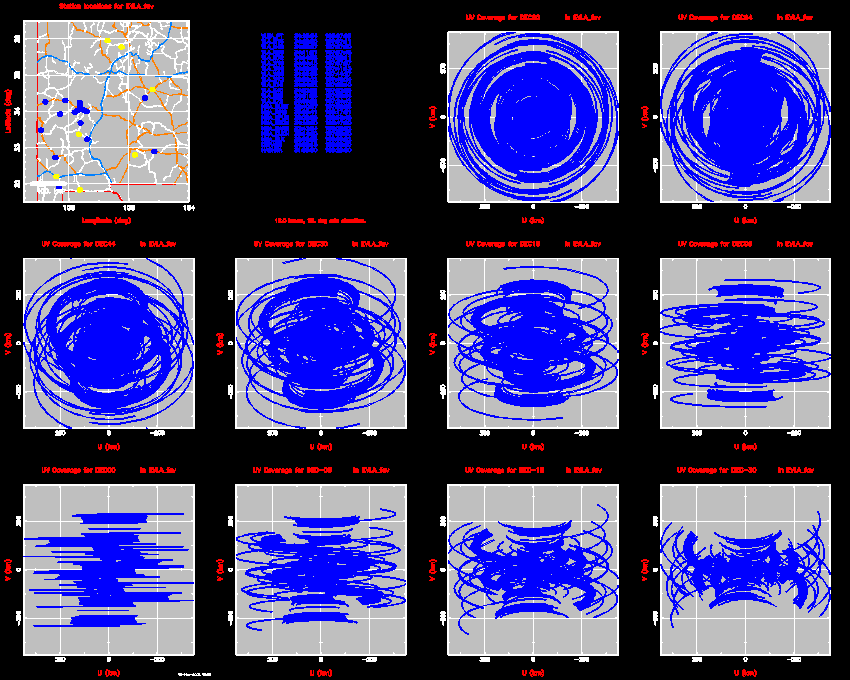
In case you can't read the microprint, the sources are at 80, 64, 44, 30, 18, 6, 0, -6, -18, and -30 degrees declination. On the map, the sites marked in blue are those included in the array. Ignore the yellow dots.
VLA+NMA on a 350 km scale:
VLA+NMA on a 100 km scale:
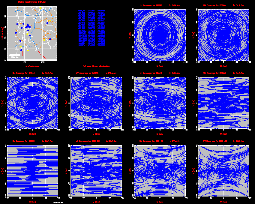
NMA alone on a 350 km scale:
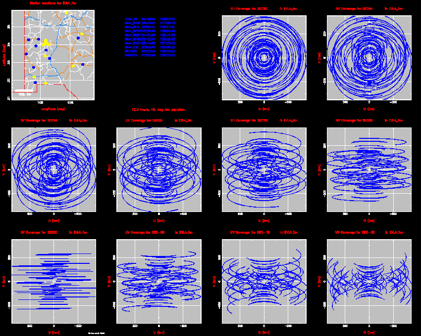
VLA + NMA + Kitt Peak + Fort Davis on a 650 km scale. This shows the uv advantage of including the VLBA stations at KP and FD in the NMA.
NMA + VLBA on a 2000 km scale.