Here are some UV plots for my current favorite configuration as of
Dec2001. I am still working on the problem, and Leonia is running his
optimizations, so hopefully this is a minimum of what we can do.
There are some holes at about 70 km that I'm not too happy with, so
there may well be changes.
The new stations are:
EMRTC - basically Socorro. Engineering should love this.
RR107 - on the railroad near where Rt 107 reaches I25 south
of Socorro. There is fiber along the railroad.
AGUSTINS - The very southwest corner of the Plains of San Agustin.
This one will probably require something like 12 miles of new fiber.
COOLIDGE - A bit east of Gallup. There are major fibers there.
Anywhere near Gallup would probalby be ok.
ENGLE - Along the railroad near T or C. This would use the same
fiber as the RR107 site.
GLENWOOD - On the west side of the Gila Wilderness. The Western
New Mexico fiber goes through there.
VAUGHN - To the east. Our maps show ENMR-Plateau
Telecommunications fiber there.
TINNIE - On US 380 west of Roswell. Our maps show a Penasco
Valley Telephone Cooperative fiber along that road.
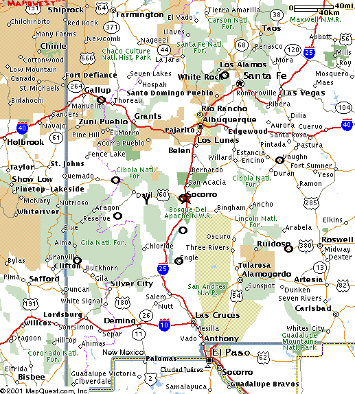
A map of the configuration. The antenna positions are approximate - inserted with the text tool in the Gimp..
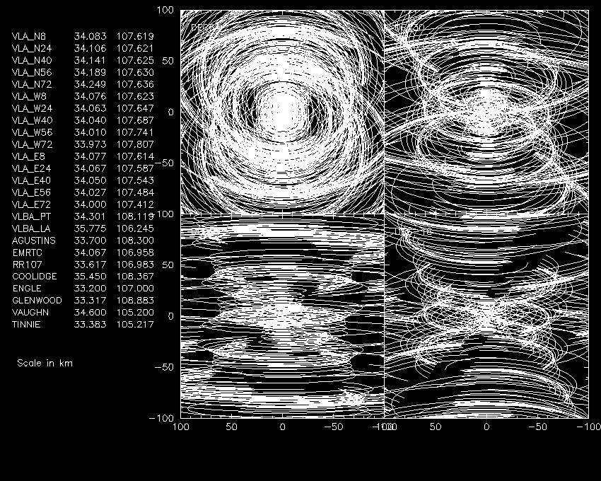
The VLA + NMA on a scale of 100 km.
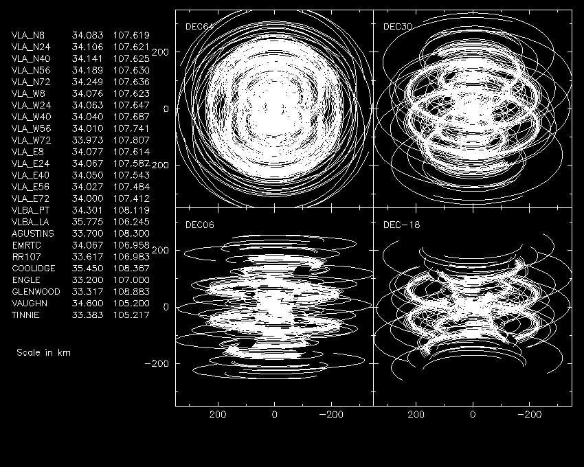
The VLA + NMA on a scale of 350 km.
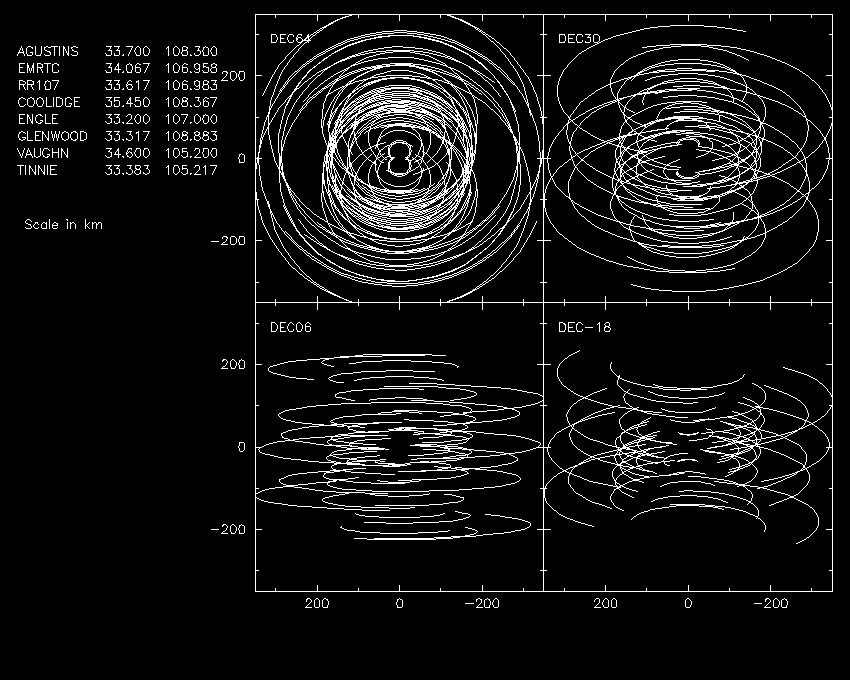
The NMA with Pie Town and Los Alamos on a scale of 350 km.
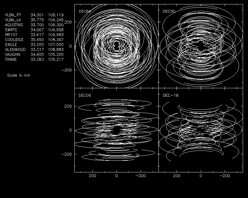
The NMA without Pie Town and Los Alamos on a scale of 350 km.
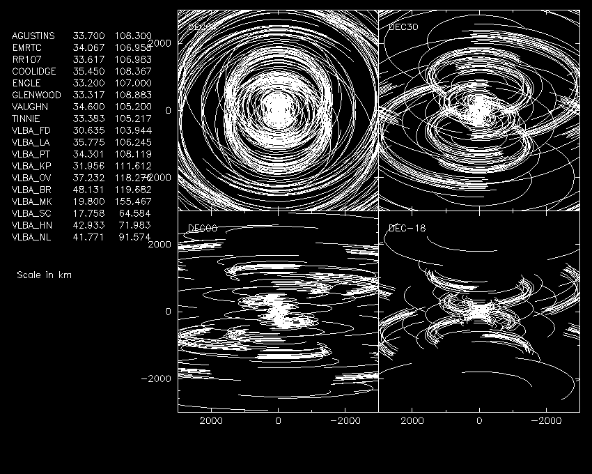
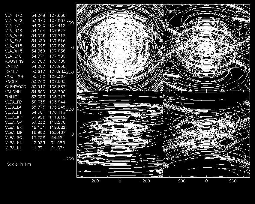
The VLA + NMA + VLBA on a scale of 350 km.
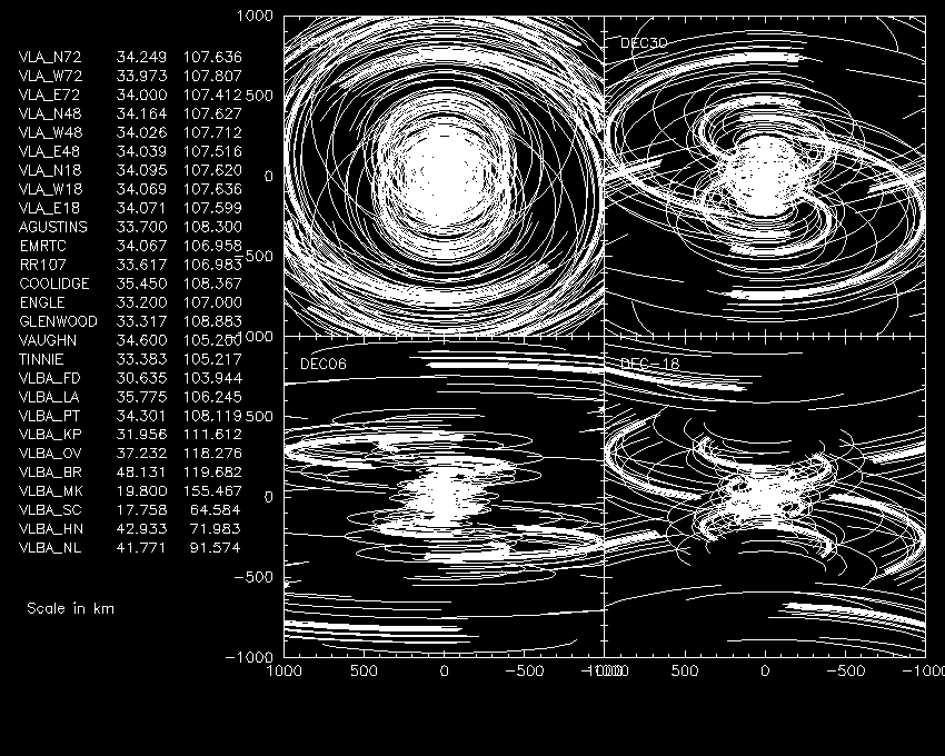
The VLA + NMA + VLBA on a scale of 1000 km.
The NMA + VLBA on a scale of 3000 km.